Come and discover our beautiful Catalan village, come and share the warmth of our festivals and walk our trails marvelling at the beautiful mountain scenery. Challenge yourself by taking part in our mountain races, and feel our history through the traditional architecture that can be seen in our houses with their red stone walls. You will be greeted with a smile by our inhabitants, you will be able to eat at the village restaurant and relax in our rural lodgings.


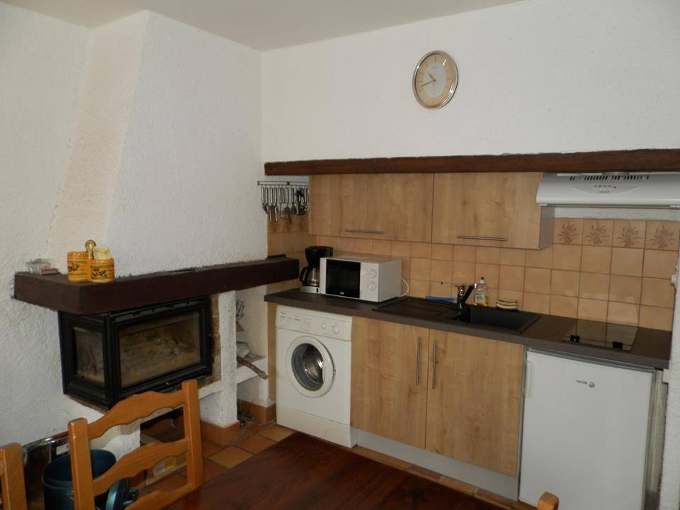
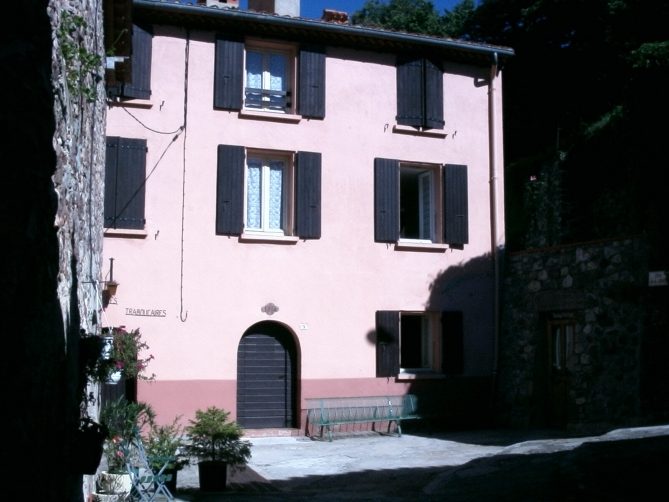
Village gite-apartments
They are in the old presbytery, in the heart of the village and near the hiking trails.
Each includes:
A living room (with kitchen area, wood burning insert and double sofa bed),
- A living room (with kitchen area, wood burning insert and double sofa bed),
- 1 bedroom with 1 double bed,
- 1 bedroom with 2 single beds,
- 1 bathroom and 1 toilet.
The apartments are available all year round; they can by rented by the night, the weekend or the week.
Rates :
| Overnight stay | 40€ / gîte |
| Weekend (from Friday at 4PM to Sunday 10AM) | 70€ / gîte |
| Weekly (from Saturday at 4PM to Saturday 10AM) | 280€ / gîte |
|
|
|
Contact the townhall to reserve by telephone at 04 68 39 52, or by email at secretariat.mairie@lamanere.fr.
Connect with us on Facebook at: Facebook des GÎTES Communaux De Lamanère
Hikes
| Southernmost Point Circuit emblématique du village le plus au sud de la France, il vous conduira au totem symbolisant le point le plus au sud et vous permettra de suivre la crête frontalière par le Coma Negra (1550m) jusqu’au col de Malrems. Vous découvrirez un panorama exceptionnel de la chaîne des pyrénées. Attention randonnée sportive avec un profil important. More information [currently only in French] |
|
||||||||||
| Sainte Christine
This hike, ideal for all the family, is enjoyable all year round. It brings you to a very small 13th century chapel, topped by a slender bell tower. |
|
||||||||||
| The Hermitage of Notre Dame du Coral
A must-do hike from Lamanere; the trail that you follow climbs slowly through a vast area of forest composed primarily of chestnut and beech. Nestled in this environment is the majestic Hermitage of ND du Coral. The hermitage and its surroundings, ideal for contemplation, will not leave you indifferent. |
|
||||||||||
| The Cabrenç Towers
Reaching the Cabrenç Towers from the village involves a rigorous but beautiful hike. Situated on a rocky spur with a 360° view including the sea, there are two magnificent towers and the remains of a third. |
|
||||||||||
| Les Tours de Cabrenç – Retour par le Pla de Casteil
This variant permits you to return by a different route to Lamanere. Careful, note that the first part involves a steep descent through the forest. The trail after reaching the Pla de Casteil is very easy. |
|
||||||||||
| Lamanere, col de Malrens, Notre Dame du Coral
A superb hike, straddling the border ridge between the Col de Malrens [Malrens Pass] 1131m and the Col de les Moles 1436m. This hike will offer you exceptional views of both the Spanish side and the Canigou massif. To be undertaken only on clear days! A good knowledge of orienteering is necessary for this route! |
|
||||||||||
| Lamanere, Cabrenç Towers, Pla de la Muga, col del FalguerésLamanère, Tours de Cabrens, Pla de la Muga, col del Falguerés
To climb to the top of the first tower (1290m), get the key from the cafe/restaurant in Serralongue. |
|
||||||||||
| Lamanère, Col de Malrens, Roca Bruna, Collade de Bernadeille, Notre Dame du Coral du Coral |
|
VTT Tour
| VTT Tour n°1 – Boucle du Pla de Casteil |
|